Start your setup with the main modules and add additional options to customize your solution to your needs.
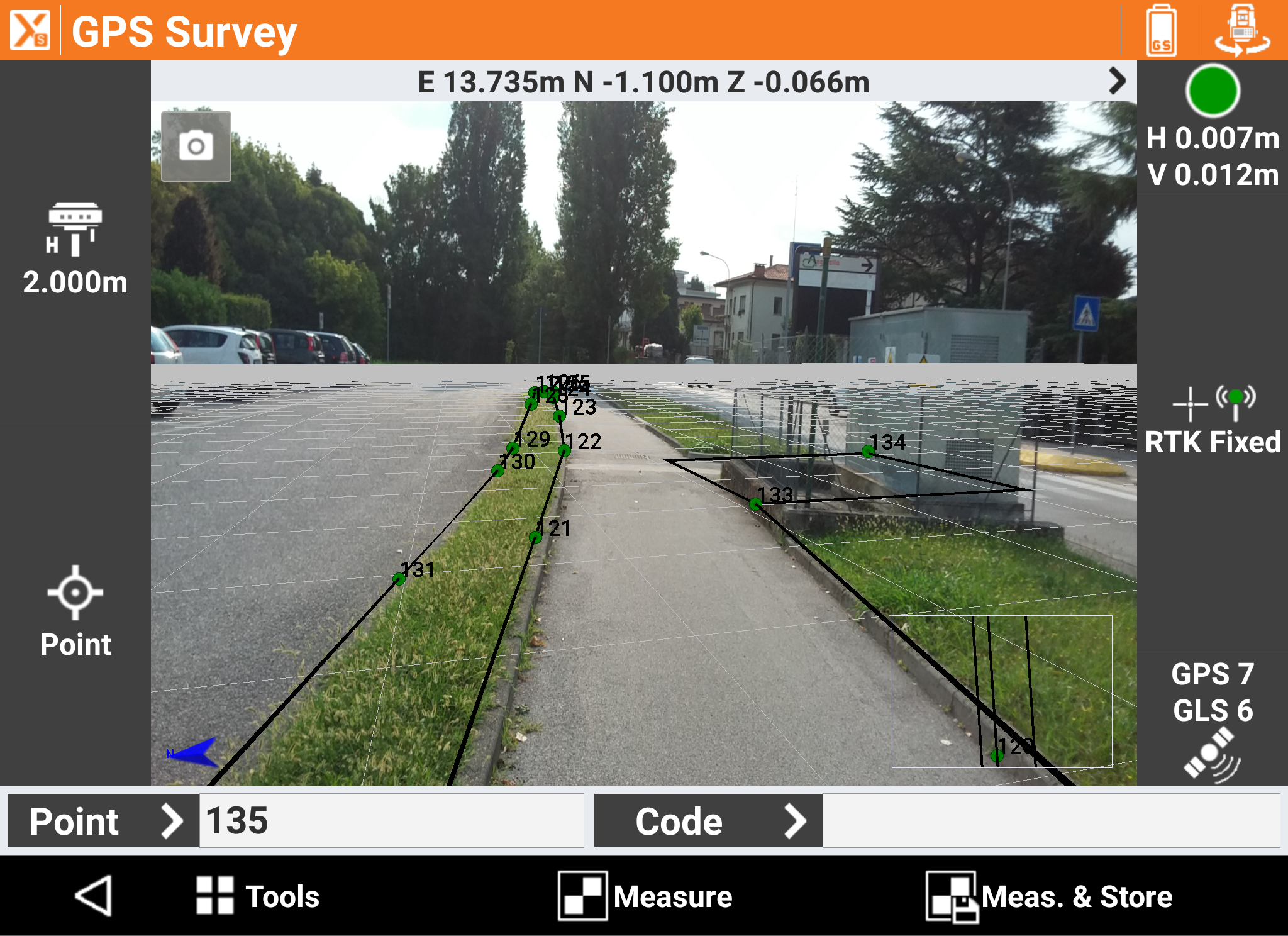
Includes all functionalities for survey, stakeout and control with GNSS receivers.
Includes all functionalities for survey, stakeout and control with the mechanical total station.
Exclusive bundle of the modules that are used most in the field: includes GNSS, TPS, and Robotic TPS.
Complete the Premium bundle with additional modules: GNSS, TPS, Robotic, Build Extension, Road, Volume, X-Pole, GIS, BIM, and Locators.
Extend the TPS main module with features that allow full control of motorized and robotic total stations.
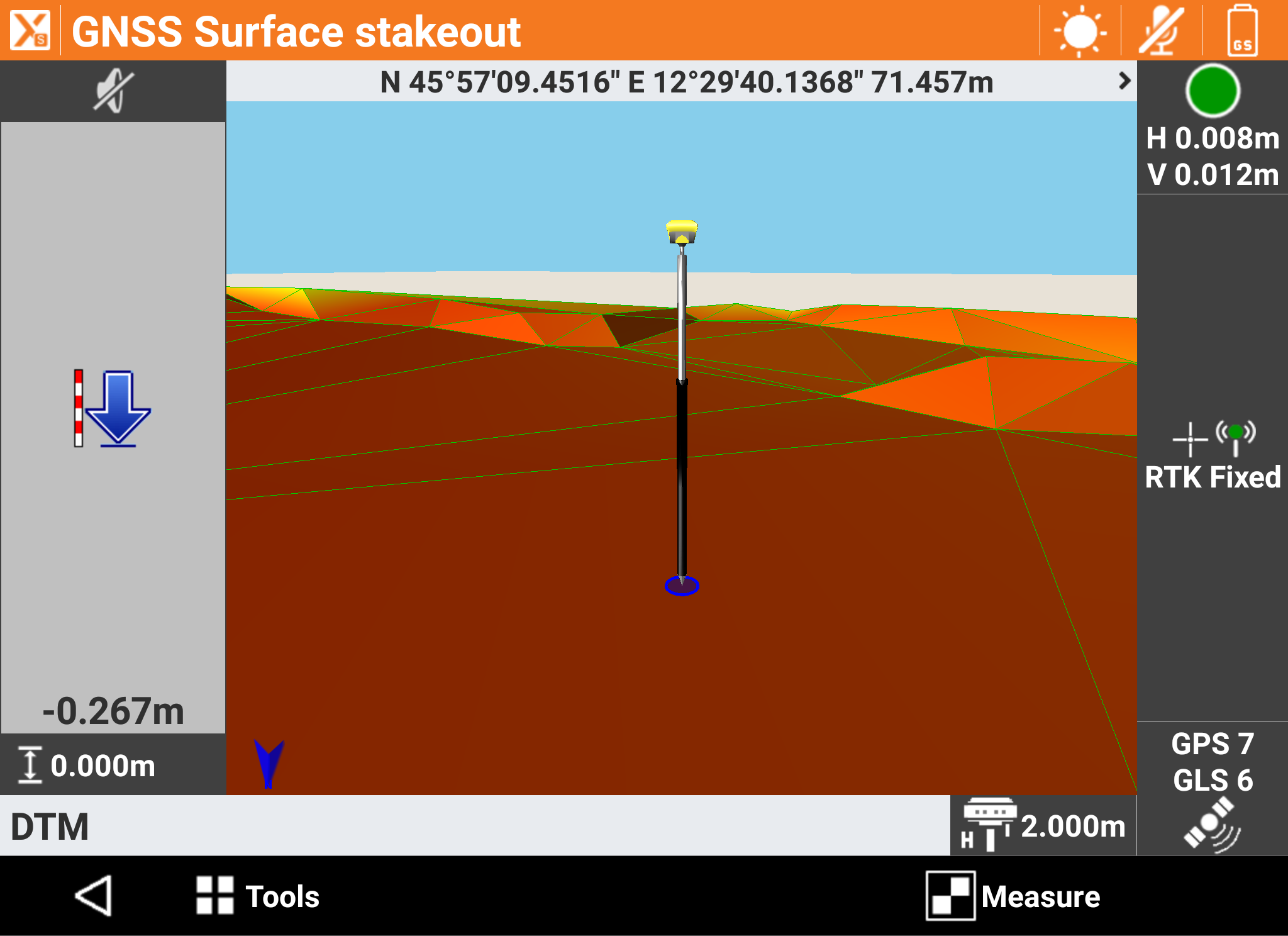
Create and import 3D surfaces to be used for all stakeout operations. It includes functions for the calculation of the volumes according to different methods.
Manage bathymetric surveys by acquiring depth data from echo sounder and GNSS positions. This includes a route control.
Import road design data from different formats and stakeout any element in the alignment in various ways.
Captures and photo processes allow you to place the measurement of points directly on the photos themselves.
Flexibly work with TPS and GNSS at the same time, by using the best features of each system.
Define GIS features and attributes to be assigned to measured points. It includes import and export functions of GIS data.
Connect to utility locators and record depths at corresponding GNSS positions.
Import BIM models, display, navigate and extract information (points, lines, surfaces) for checking and stakeout operations.
Extend the Survey version with all the features that are exclusively made for the Build version.
Set of commands designed for mechanical, electrical and plumbing, transfer heights, create parallel lines, on surfaces, and scan lines.
See how Remote Mapping Group surveys with drones and X-PAD software.
"The GeoMax products that I'm using now cut my time for surveying by a third."
Caleb Sears,
Drone Surveyor Pilot
Remote Mapping Group
Grant Shepherd & Associates uses X-PAD to stake the track at the Atlanta Motor Speedway.
"The platform, the versatility, the functionality of X-PAD is far superior to any other software that we've used in the past."

William Shepherd,
Director of Planning & Surveying
Grant Shepherd & Associates
EMC Engineering gives their testimony about X-PAD Ultimate Survey during a joint training session with eGPS Solutions and GeoMax.
"We chose X-PAD software because of the ease of use...It's very user friendly, easy to use so that was probably the biggest reason we've chose that."

Wesley Weitman
Statesboro Survey Dept. Head
EMC Engineering Services Inc.
EMC Engineering Surveyors share the value of X-PAD Ultimate Field Software during a joint training session with eGPS Solutions and GeoMax.
"So what happens...with X-PAD [we can] upload our CAD drawings, aerial images, and some linework that it produces [while] in the field. It makes us more efficient; it cuts down on some of the drafting time...so that aspect alone makes us more efficient."

Chris Brazell
Chief Operations Officer
EMC Engineering Services, Inc.
There's always a learning curve when it comes to new software. We get it.
Our technical support staff at eGPS Solutions is here to help you learn the ins and outs and answer any questions you may have on X-PAD.